Customers⎯Jun 23, 2026
Case Study: How a Plantation Operator Unified Monitoring Across 5,000 Hectares
Transforming Plantation Monitoring: Unifying Data Across 5,000 Hectares with Avirtech Biota
Case Study : Precision Agriculture ; Real-Time IoT Dashboard Integration
Across 5,000 hectares, one dashboard now drives real-time decisions.
This is how a plantation operator transformed their monitoring operations — by unifying disconnected data streams through Avirtech's Biota platform.
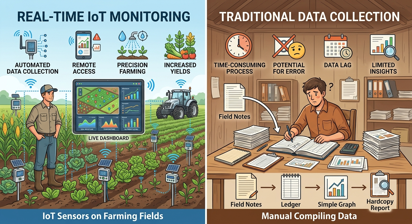
The Challenge: Data Everywhere, Insight Nowhere
Data was pouring in from Automatic Weather Stations, water level sensors, drone surveys, and manual field logs — but all of it trapped in silos.
The consequences were real:
Delayed Analytics; Reporting cycles took days
Reactive Management; Anomaly detection was retrospective
Innefficient Auditing; Compliance data required manual compilation — slow, error-prone, and delayed
The Deployment : Comprehensive IoT and Drone Mapping
To overcome these bottlenecks, the plantation executed a comprehensive technology rollout designed for maximum coverage and data accuracy :
Microclimate Monitoring : AWS stations installed across the estate to capture microclimate data at field level
Peatland Management : Water level sensors positioned at critical drainage points to monitor peatland water table fluctuations
Aerial Intelligence : Drone mapping missions flying regular orthomosaic surveys to track terrain changes and infrastructure conditions
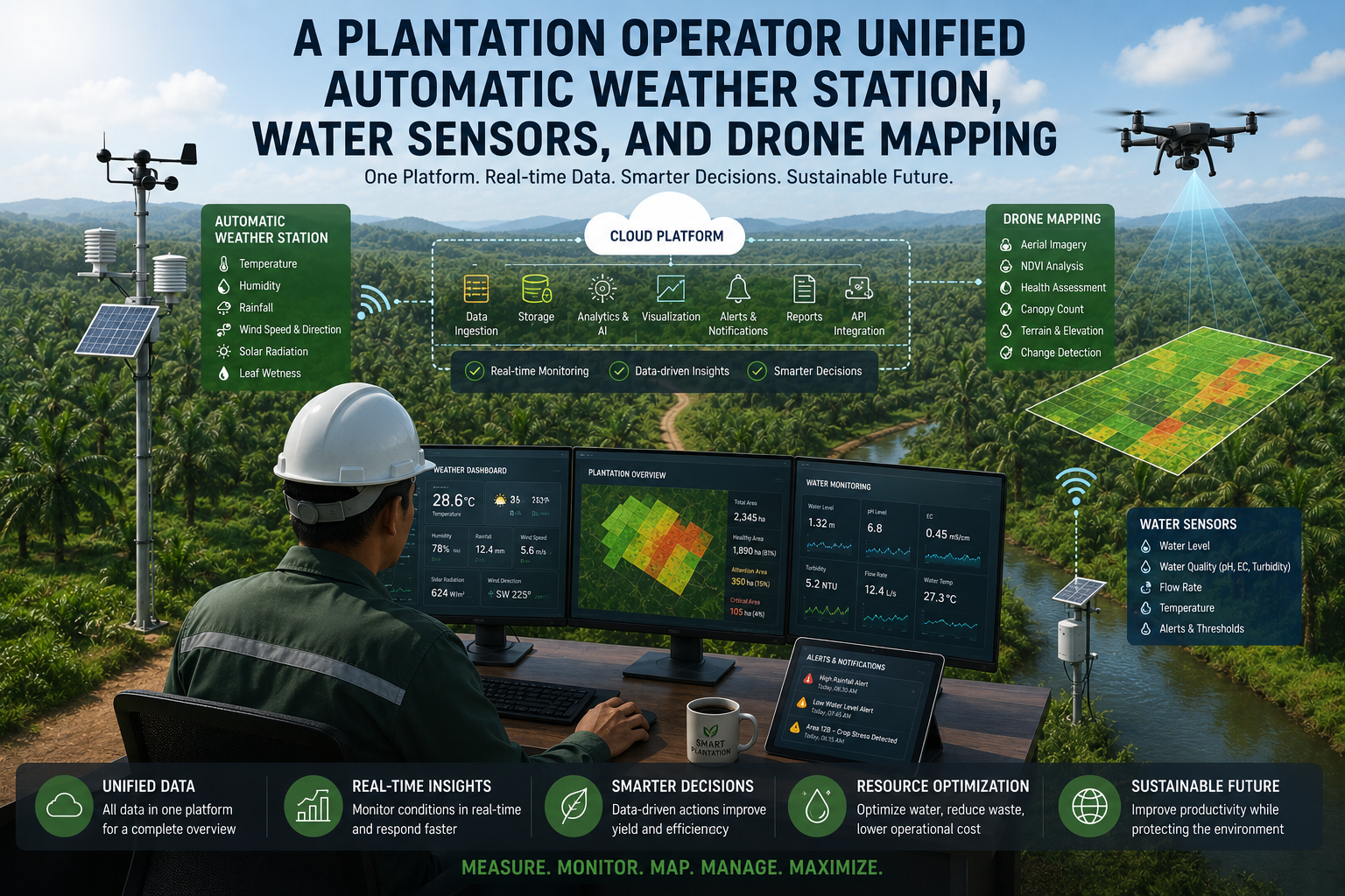
The Critical Step : Platform Integration
All data streams were connected via Biota into a single georeferenced operational view.
Weather data, water metrics, and aerial imagery were no longer separate reports — they became layers on the same map, time-synchronized and spatially correlated.
Measurable Operational Results.
The transformation yielded immediate, quantifiable improvements across the plantation :
Accelerated Reporting : The reporting cycle collapsed from days to mere minutes
Reduced Labor Costs : Field monitoring labor requirements dropped by 40 percent, as continuous automated streaming replaced periodic manual inspections.
Enhanced Monitoring Coverage : Sensor coverage actually increased, measuring conditions every hour instead of just during weekly rounds.
Real-Time Compliance : Water compliance improved significantly because threshold breaches were detected in real time rather than discovered during quarterly audits.
Faster Response Rates : Anomaly response times shrank from days to hours.
Crucially for regulators, the operator could now export a complete, timestamped, georeferenced data trail demonstrating compliance at any point in time.
The value of precision agriculture technology multiplies when individual tools are integrated into a unified system.
Sensors, drones, and platforms working together deliver outcomes that no single technology can achieve alone.