
Products & Services
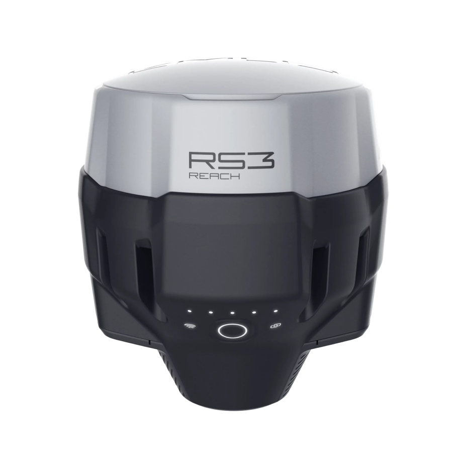
Emlid Reach RS3
RTK GNSS receiver with tilt compensation, survey-grade precision, multi-band capabilities, and LTE modem for challenging environments.
Gets a fix in 5 seconds
Reach RS3 gets a centimeter-accurate solution in about 5 seconds. It maintains robust performance even when the sky view is partially obstructed, or the receiver itself is tilted.
RINEX logging and PPP support
Reach RS3 quickly achieves centimeter accuracy in 5 seconds, maintaining robust performance despite obstructions or tilting.
Built-in LTE modem
Insert a SIM card into your Reach RS3 to enable broadcasting or receiving corrections via NTRIP effortlessly.
22 hours on a single charge
Reach RS3 features a robust built-in battery lasting up to 22 hours for logging or 18 hours for tilt-enabled RTK operation. Simply connect a power bank for multi-day use.
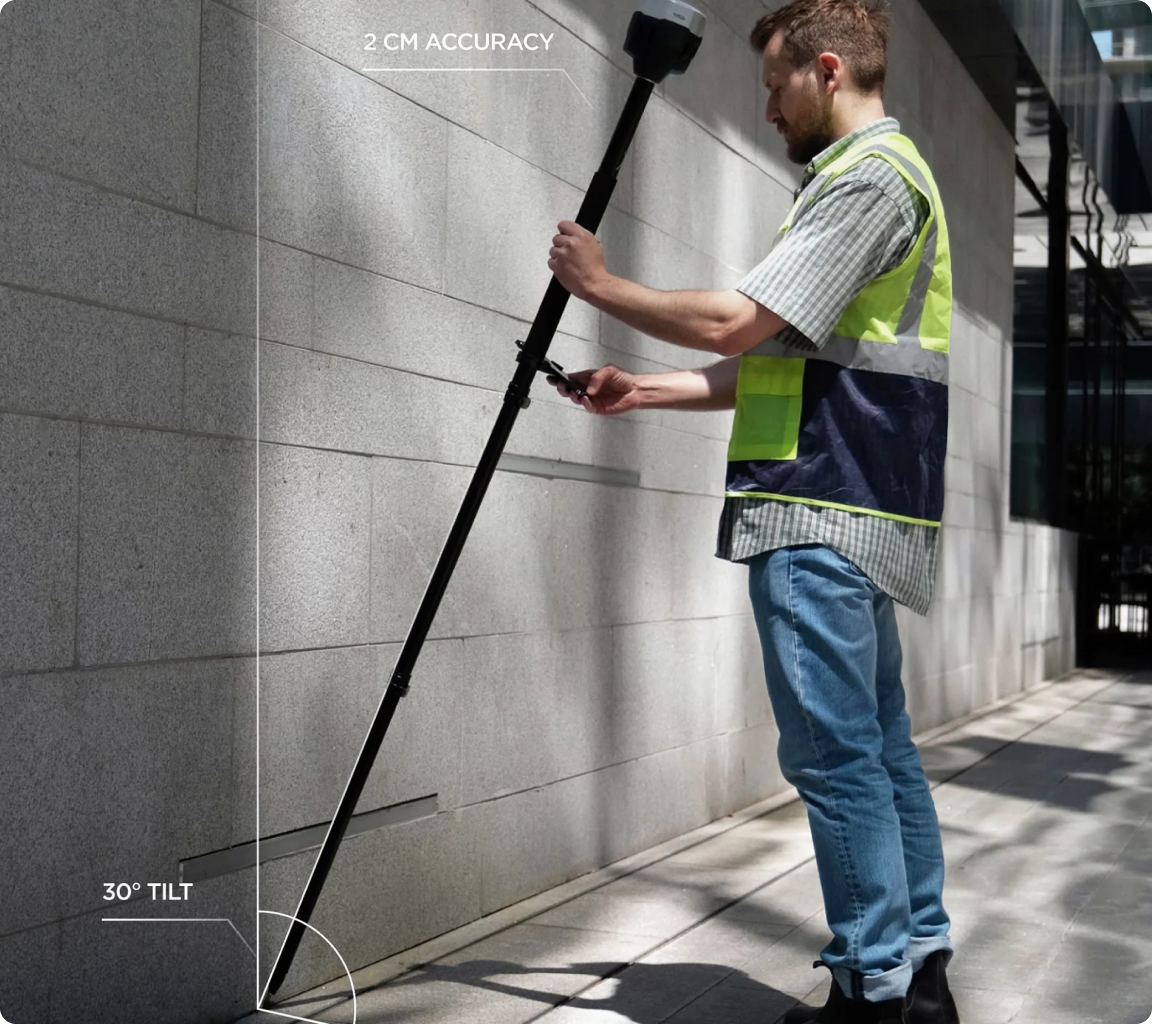
Accurate results even with large tilt angles
The IMU-based tilt compensation in Reach RS3 enables you to make measurements with up to 60 degrees of tilt while still staying within 20 mm of accuracy.
Reach RS3 continuously measures and corrects tilt in real-time to keep you on target.
Calibration-free
We calibrate the inertial measurement unit in each device individually at the factory, so you can get your Reach RS3 up and running right out of the box.
Immune to magnetic disturbances
Unaffected by magnetic fields, RS3’s IMU sensors provide robust tilt compensation even when working close to metal structures.
Quick initialization
Tilt initialization takes about 20 meters of walking or 10-20 seconds of tilting. Usually ready on the way from the car.
Rugged and compact
Dense forests, mountains, frost, heat and water, Reach RS3 can handle them all
IP67
RS3 is waterproof up to a one meter depth. Silicone plugs completely seal and protect all connectors from water and dust.
-20ºС…+65ºС
We extensively tested Reach RS3 in conditions that simulate the coldest winters and hottest summers.
Industrial battery
The Reach RS3 Li-Ion battery handles high and low temperatures well and over 2000 cycles of charging and discharging while maintaining its original capacity.
Impact-resistant
The body of the Reach RS3 is made of polycarbonate and coated with elastomer. The combination of these materials makes your Reach RS3 drop resistant and ready for the harshest conditions.
NTRIP (Band and Rover)
Work in RTK with VRS or a single baseline CORS network. You can also connect another GNSS receiver as an NTRIP base using Emlid NTRIP Caster.
Compatible
Any receiver with RTCM3 support
Dual-band radio
LoRa 868/915 MHz (Base and Rover)
Perfect for areas with no internet coverage for NTRIP. LoRa is used when connecting Emlid receivers over the radio.
Compatible
All Emlid receivers with built-in radio.
UHF 450 MHz Rover
An option to mix and match RTK receivers within your fleet. You can configure your Reach RS3 to receive corrections from an existing base*. You can also use a high-power external radio on your Reach base and connect with the UHF radio receiver in Reach RS3.
Compatible
Bases with radios that transmit TRIMTALK 450S**
Technical specifications
Positioning
Static
H: 4 mm + 0.5 ppm
V: 8 mm + 1 ppm
PPK
H: 5 mm + 0.5 ppm
V: 10 mm + 1 ppm
RTK
H: 7 mm + 1 ppm
V: 14 mm + 1 ppm
Convergence time
~5 s typically
Tilt compensation
~5 s typically
Signal tracked
GPS/QZSS L1C/A, L2C, GLONASS L1OF, L2OF, BeiDou B1I, B2I, Galileo E1-B/C, E5b
Number of channels
184
Update rates
10 Hz GPS / 5 Hz GNSS
IMU
9DOF
Mechanical
Dimensions
126x126x142 mm
Weight
950 g
Operating
-20…+65 ºC
Ingress protection
IP67 (water and dust)
Connectivity
UHF LoRa radio
868/915 MHz, 0.1 W and Up to 8 km
Frequency range
868/915 MHz
Power
0.1 W
Distance
Up to 8 km
UHF radio
Receive-only*
Frequency range
410-470 MHz
Protocol
TRIMTALK 450S**
Modulation type
GMSK
LTE modem
Regions
Global
Bands
FDD-LTE: 1, 2, 3, 4, 5
7, 8, 12, 13, 18, 19, 20, 26, 28, 66
TD-LTE: 38, 40, 41
UMTS(WCDMA/FDD):
1, 3, 2, 4, 5, 6, 8, 18
Quad-band
850/1900,
900/1800 MHz
SIM card
Nano-SIM
Wi-Fi
802.11b/g/n
Bluetooth
4.0/2.1 EDR
Ports
RS-232, USB Type-C
Data Protocols
NTRIP, VRS, RTCM3, position output in NMEA, LLH/XYZ
Data logging
RINEX at update rate up to 10 Hz
Internal storage
16GB
Data
Corrections
NTRIP, RTCM3
Position output
NMEA, LLH/XYZ
Data logging
RINEX with events with update rate up to 14 Hz
Internal storage
8 GB 80+ days of logging at 1 Hz
GNSS
Signal tracked
GPS/QZSS L1, GLONASS G1 BeiDou B1, Galileo E1, SBAS
Number of channels
72
Update rates
14 Hz GPS / 5 Hz GNSS
IMU
9DOF